Live Traffic Camera: IH-10 East @ SH 99 (W) (East)
Unknown, Texas
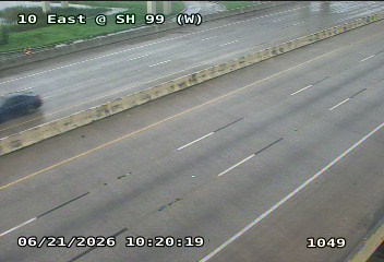
All cameras on I-10 in Texas →This traffic camera monitors I-10 in Texas, with a eastbound view.
Multiple National Weather Service alerts are active for this camera area. Review the alert details below before traveling through this corridor.
Current weather near this camera is dry, with clear sky and temperatures near 79.8 °F.
The live view is most useful for checking traffic flow, visibility, and any lane restrictions before driving through the Chambers County area.
Additional rain is expected over the next few days, which could keep pavement conditions variable in the Chambers County area.
Other cameras at this location (I-10 - ~1640ft)
- ○ IH-10 East @ SH 99 (E) East
- ● IH-10 East @ SH 99 (W) East
Camera Information & Location Details
- Highway/Roadway
- I-10
- Traffic Direction
- East
- County
- Chambers
- City
- Unknown
- Feed Type
- Still Image
- Geographic Coordinates
- 29.82420, -94.86683
- Source Provider
- TxDOT
Real-Time Mapping
Active Weather Alert near this camera
Hazardous weather is occurring or expected soon near this camera area.
Flash Flood Warning
Flash Flood Warning issued June 17 at 8:35AM CDT until June 17 at 10:30AM CDT by NWS Houston/Galveston TX
At 835 AM CDT, Doppler radar indicated thunderstorms producing heavy rain across the warned area. Between 2 and 3 inches of rain have fallen. The expected rainfall rate is 1 to 2 inches in 1 hour. Additional rainfall amounts of 0.5 to 2 inches are possible in the warned area. Flash flooding is ongoing or expected to begin shortly. HAZARD...Flash flooding caused by thunderstorms. SOURCE...Radar. IMPACT...Flash flooding of small creeks and streams, urban areas, highways, streets and underpasses as well as other poor drainage and low-lying areas. Some locations that will experience flash flooding include... Pasadena, Baytown, La Porte, Deer Park, South Houston, northern Seabrook, Galena Park, Liberty, Dayton, Beach City, Barrett, Highlands, Channelview, Cloverleaf, Kingwood, northern Clear Lake, northeastern South Belt / Ellington, Crosby, Mont Belvieu and Taylor Lake Village.
Turn around, don't drown when encountering flooded roads. Most flood deaths occur in vehicles.
- Active until
- 2026-06-17 15:30:00 UTC
- Certainty
- Likely
- Area
- Chambers, TX; Harris, TX; Liberty, TX
Tropical Storm Watch
Tropical Storm Watch issued June 17 at 10:08AM CDT by NWS Houston/Galveston TX
* LOCATIONS AFFECTED - Anahuac - Beach City - Mont Belview * WIND - LATEST LOCAL FORECAST: Below tropical storm force wind - Peak Wind Forecast: 10-15 mph with gusts to 25 mph - THREAT TO LIFE AND PROPERTY THAT INCLUDES TYPICAL FORECAST UNCERTAINTY IN TRACK, SIZE AND INTENSITY: Wind less than 39 mph - The wind threat has remained nearly steady from the previous assessment. - PLAN: The sustained wind should remain less than tropical storm force. Conditions may still be gusty. - PREPARE: Little to no preparations needed to guard against tropical winds at this time. - ACT: Ensure emergency readiness should the forecast change. - POTENTIAL IMPACTS: Little to None - Little to no potential impacts from wind. * STORM SURGE - No storm surge inundation forecast - THREAT TO LIFE AND PROPERTY THAT INCLUDES TYPICAL FORECAST UNCERTAINTY IN TRACK, SIZE AND INTENSITY: Little to no storm surge flooding - The storm surge threat has remained nearly steady from the previous assessment. - PLAN: There is little to no threat of storm surge flooding. Rough surf, coastal erosion, and life-threatening rip currents are possible. - PREPARE: Little to no preparations for storm surge flooding are needed. - ACT: Follow the instructions of local officials. Monitor forecasts. - POTENTIAL IMPACTS: Little to None - Little to no potential impacts from storm surge flooding. * FLOODING RAIN - LATEST LOCAL FORECAST: Flood Watch is in effect - Peak Rainfall Amounts: No additional significant rainfall forecast - THREAT TO LIFE AND PROPERTY THAT INCLUDES TYPICAL FORECAST UNCERTAINTY IN TRACK, SIZE AND INTENSITY: Potential for moderate flooding rain - The flooding rain threat has remained nearly steady from the previous assessment. - PLAN: Emergency plans should include the potential for moderate flooding from heavy rain. Evacuations and rescues are possible. - PREPARE: Consider protective actions if you are in an area vulnerable to flooding. - ACT: Heed any flood watches and warnings. Failure to take action may result in serious injury or loss of life. - POTENTIAL IMPACTS: Significant - Moderate rainfall flooding may prompt several evacuations and rescues. - Rivers and tributaries may quickly become swollen with swifter currents and overspill their banks in a few places, especially in usually vulnerable spots. Small streams, creeks, canals, and ditches overflow. - Flood waters can enter some structures or weaken foundations. Several places may experience expanded areas of rapid inundation at underpasses, low-lying spots, and poor drainage areas. Some streets and parking lots take on moving water as storm drains and retention ponds overflow. Driving conditions become hazardous. Some road and bridge closures. * TORNADO - LATEST LOCAL FORECAST: - Situation is somewhat favorable for tornadoes - THREAT TO LIFE AND PROPERTY THAT INCLUDES TYPICAL FORECAST UNCERTAINTY IN TRACK, SIZE AND INTENSITY: Potential for a few tornadoes - The tornado threat has remained nearly steady from the previous assessment. - PLAN: Emergency plans should include the potential for a few tornadoes. - PREPARE: If your shelter is particularly vulnerable to tornadoes, prepare to relocate to safe shelter before hazardous weather arrives. - ACT: If a tornado warning is issued, be ready to shelter quickly. - POTENTIAL IMPACTS: Limited - The occurrence of isolated tornadoes can hinder the execution of emergency plans during tropical events. - A few places may experience tornado damage, along with power and communications disruptions. - Locations could realize roofs peeled off buildings, chimneys toppled, mobile homes pushed off foundations or overturned, large tree tops and branches snapped off, shallow-rooted trees knocked over, moving vehicles blown off roads, and small boats pulled from moorings. * FOR MORE INFORMATION: - Hurricane Preparedness: Federal Emergency Management Agency - http://ready.gov/hurricanes - Local weather conditions and forecasts: NWS Houston/Galveston, TX - http://www.weather.gov/hgx/
- Active until
- 2026-06-18 00:00:00 UTC
- Certainty
- Possible
- Area
- Chambers
Flood Watch
Flood Watch issued June 17 at 9:43AM CDT until June 17 at 7:00PM CDT by NWS Houston/Galveston TX
* WHAT...Flooding caused by excessive rainfall continues to be possible. * WHERE...A portion of southeast Texas, including the following areas, Bolivar Peninsula, Brazoria Islands, Chambers, Coastal Brazoria, Coastal Galveston, Coastal Harris, Galveston Island, Inland Brazoria, Inland Galveston, Inland Harris, Northern Liberty and Southern Liberty. * WHEN...Until 7 PM CDT this evening. * IMPACTS...Excessive runoff may result in flooding of rivers, creeks, streams, and other low-lying and flood-prone locations. Extensive street flooding and flooding of creeks and rivers are possible. * ADDITIONAL DETAILS... - Coastal areas will have the greatest potential for flooding through this afternoon. Rainfall rates of 2-2.5 inches per hour are possible in the heaviest downpours. Additional widespread rainfall amounts of 1 to 2 inches in the watch are expected with isolated higher totals possible especially along the coast. Grounds are fairly saturated across portions of Southeast Texas, which would allow for a quicker transition of the rainfall to runoff. This increases the potential for flooding, especially in the areas that have received 4+ inches of rain over the past few days. - http://www.weather.gov/safety/flood
You should monitor later forecasts and be alert for possible Flood Warnings. Those living in areas prone to flooding should be prepared to take action should flooding develop.
- Active until
- 2026-06-18 00:00:00 UTC
- Certainty
- Possible
- Area
- Northern Liberty; Inland Harris; Chambers; Inland Brazoria; Inland Galveston; Southern Liberty; Coastal Harris; Coastal Brazoria; Coastal Galveston; Brazoria Islands; Galveston Island; Bolivar Peninsula
Current Weather near traffic camera in Unknown, Texas
Clear sky
- Temperature
- 79.8 °F
- Feels Like
- 83.7 °F
- Humidity
- 88%
- Wind
- 17.7 mph
- Wind Direction
- ESE (113°)
- Precipitation
- 0.00 inch
Forecast
- Max
- 84.5 °F
- Min
- 75.5 °F
- Precip.
- 0.38 inch
- Status
- Moderate rain
- Max
- 89.2 °F
- Min
- 77.6 °F
- Precip.
- 0.04 inch
- Status
- Slight rain
- Max
- 89.0 °F
- Min
- 79.8 °F
- Precip.
- 0.00 inch
- Status
- Clear sky
Observed at: 2026-06-17 15:00 UTC (weather data updated hourly)
Nearby Cameras
IH-10 East @ SH 99 (E)
Unknown
I-10
Direction: East
Distance: 0.1 miles
SH99 @ Old Needlepoint Rd
Unknown
TX-99
Direction: East
Distance: 0.6 miles
IH-10 East @ NeedlePoint Rd
Unknown
I-10
Direction: East
Distance: 0.6 miles
IH-10 East @ NeedlePoint Rd (W)
Unknown
I-10
Direction: East
Distance: 1.0 miles
SH99 @ FM 565N (S)
Mont Belvieu
TX-99
Direction: East
Distance: 1.1 miles
SH99 @ Kilgore Pkwy
Unknown
TX-99
Direction: East
Distance: 1.4 miles
IH-10 East @ SH 146 (E)
Baytown
I-10
Direction: East
Distance: 1.5 miles
SH99 @ FM 565N
Mont Belvieu
TX-99
Direction: East
Distance: 1.9 miles
IH-10 East @ SH 146
Baytown
I-10
Direction: East
Distance: 2.0 miles