Live Traffic Camera: BMT - IH-10 @ Kid Gully (East)
Unknown, Texas
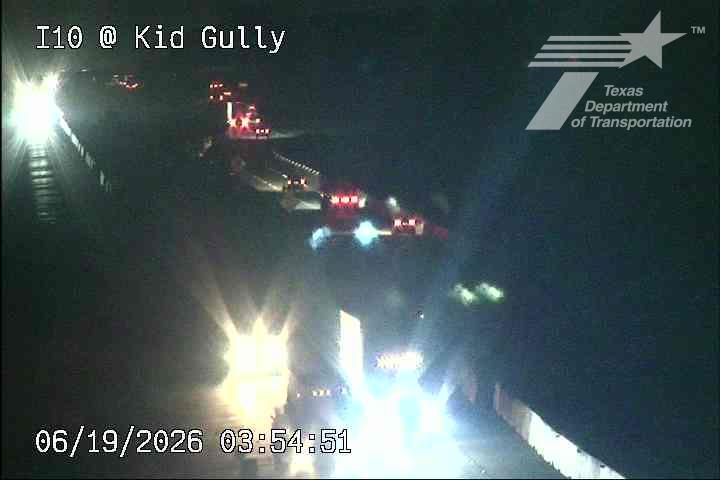
All cameras on I-10 in Texas →This traffic camera monitors I-10 in Texas, with a eastbound view.
Multiple National Weather Service alerts are active for this camera area. Review the alert details below before traveling through this corridor.
Light rain is reported near this camera, with temperatures near 83.6 °F. Allow extra braking distance and watch for spray from nearby traffic.
Additional rain is expected over the next few days, which could keep pavement conditions variable in the Jefferson County area.
Camera Information & Location Details
- Highway/Roadway
- I-10
- Traffic Direction
- East
- County
- Jefferson
- City
- Unknown
- Feed Type
- Still Image
- Geographic Coordinates
- 29.97393, -94.22160
- Source Provider
- TxDOT
Real-Time Mapping
Active Weather Alert near this camera
Hazardous weather is occurring or expected soon near this camera area.
Tropical Storm Warning
Tropical Storm Warning issued June 17 at 11:37AM CDT by NWS Lake Charles LA
* LOCATIONS AFFECTED - Nederland - Port Arthur - Sabine Pass - Sea Rim State Park * WIND - LATEST LOCAL FORECAST: Below tropical storm force wind - Peak Wind Forecast: 10-15 mph with gusts to 25 mph - THREAT TO LIFE AND PROPERTY THAT INCLUDES TYPICAL FORECAST UNCERTAINTY IN TRACK, SIZE AND INTENSITY: Wind less than 39 mph - The wind threat has remained nearly steady from the previous assessment. - PLAN: The sustained wind should remain less than tropical storm force. Conditions may still be gusty. - PREPARE: Listen for any instructions from local officials. - ACT: Ensure emergency readiness should the forecast change. - REALIZED IMPACTS: Being Assessed - Little to no additional wind impacts expected. Community officials are now assessing the extent of actual wind impacts accordingly. * STORM SURGE - LATEST LOCAL FORECAST: Life-threatening storm surge possible - Peak Storm Surge Inundation: The potential for 2-4 feet above ground somewhere within surge prone areas - Window of concern: Begins this morning - THREAT TO LIFE AND PROPERTY THAT INCLUDES TYPICAL FORECAST UNCERTAINTY IN TRACK, SIZE AND INTENSITY: Potential for storm surge flooding greater than 3 feet above ground - The storm surge threat has remained nearly steady from the previous assessment. - PLAN: Plan for life-threatening storm surge flooding of greater than 3 feet above ground. - PREPARE: Storm surge flooding preparations should be underway. Assemble disaster supplies and know your evacuation route. - ACT: Leave if evacuation orders are given for your area. Failure to heed evacuation orders may result in the loss of your life. - POTENTIAL IMPACTS: Significant - Areas of inundation with storm surge flooding accentuated by waves. Damage to several buildings, mainly near the coast. - Sections of near-shore escape routes and secondary roads become weakened or washed out, especially in usually vulnerable low spots. - Major beach erosion with heavy surf breaching dunes. Strong and numerous rip currents. - Moderate damage to marinas, docks, boardwalks, and piers. Several small craft broken away from moorings, especially in unprotected anchorages. * FLOODING RAIN - LATEST LOCAL FORECAST: Flood Watch is in effect - Peak Rainfall Amounts: Additional around 1 inch - THREAT TO LIFE AND PROPERTY THAT INCLUDES TYPICAL FORECAST UNCERTAINTY IN TRACK, SIZE AND INTENSITY: Potential for moderate flooding rain - The flooding rain threat has remained nearly steady from the previous assessment. - PLAN: Emergency plans should include the potential for moderate flooding from heavy rain. Evacuations and rescues are possible. - PREPARE: Consider protective actions if you are in an area vulnerable to flooding. - ACT: Heed any flood watches and warnings. Failure to take action may result in serious injury or loss of life. - POTENTIAL IMPACTS: Significant - Moderate rainfall flooding may prompt several evacuations and rescues. - Rivers and tributaries may quickly become swollen with swifter currents and overspill their banks in a few places, especially in usually vulnerable spots. Small streams, creeks, canals, and ditches overflow. - Flood waters can enter some structures or weaken foundations. Several places may experience expanded areas of rapid inundation at underpasses, low-lying spots, and poor drainage areas. Some streets and parking lots take on moving water as storm drains and retention ponds overflow. Driving conditions become hazardous. Some road and bridge closures. * TORNADO - LATEST LOCAL FORECAST: - Situation is somewhat favorable for tornadoes - THREAT TO LIFE AND PROPERTY THAT INCLUDES TYPICAL FORECAST UNCERTAINTY IN TRACK, SIZE AND INTENSITY: Potential for a few tornadoes - The tornado threat has remained nearly steady from the previous assessment. - PLAN: Plans should still include the potential for a few tornadoes. - PREPARE: Keep informed should additional weather alerts be needed. - ACT: If a tornado warning is issued, be ready to shelter quickly. - POTENTIAL IMPACTS: Limited - The occurrence of isolated tornadoes can hinder the execution of emergency plans during tropical events. - A few places may experience tornado damage, along with power and communications disruptions. - Locations could realize roofs peeled off buildings, chimneys toppled, mobile homes pushed off foundations or overturned, large tree tops and branches snapped off, shallow-rooted trees knocked over, moving vehicles blown off roads, and boats pulled from moorings.
- Active until
- 2026-06-18 00:45:00 UTC
- Certainty
- Likely
- Area
- Lower Jefferson
Heat Advisory
Heat Advisory issued June 17 at 1:20AM CDT until June 17 at 8:00PM CDT by NWS Norman OK
* WHAT...For the first Heat Advisory, heat index values up to 108 expected. For the second Heat Advisory, heat index values up to 108 expected. * WHERE...In Oklahoma, Jefferson and Cotton Counties. In Texas, Archer, Baylor, Clay, Foard, Knox, Wichita, and Wilbarger Counties. * WHEN...For the first Heat Advisory, from 1 PM this afternoon to 8 PM CDT this evening. For the second Heat Advisory, from 1 PM to 8 PM CDT Thursday. * IMPACTS...Hot temperatures and high humidity may cause heat illnesses.
Drink plenty of fluids, stay in an air-conditioned room, stay out of the sun, and check up on relatives and neighbors.
- Active until
- 2026-06-18 01:00:00 UTC
- Certainty
- Likely
- Area
- Cotton; Jefferson; Foard; Wilbarger; Wichita; Knox; Baylor; Archer; Clay
Heat Advisory
Heat Advisory issued June 17 at 1:20AM CDT until June 18 at 8:00PM CDT by NWS Norman OK
* WHAT...For the first Heat Advisory, heat index values up to 108 expected. For the second Heat Advisory, heat index values up to 108 expected. * WHERE...In Oklahoma, Jefferson and Cotton Counties. In Texas, Archer, Baylor, Clay, Foard, Knox, Wichita, and Wilbarger Counties. * WHEN...For the first Heat Advisory, from 1 PM this afternoon to 8 PM CDT this evening. For the second Heat Advisory, from 1 PM to 8 PM CDT Thursday. * IMPACTS...Hot temperatures and high humidity may cause heat illnesses.
Drink plenty of fluids, stay in an air-conditioned room, stay out of the sun, and check up on relatives and neighbors.
- Active until
- 2026-06-19 01:00:00 UTC
- Certainty
- Likely
- Area
- Cotton; Jefferson; Foard; Wilbarger; Wichita; Knox; Baylor; Archer; Clay
Current Weather near traffic camera in Unknown, Texas
Rain: Slight
- Temperature
- 83.6 °F
- Feels Like
- 88.8 °F
- Humidity
- 78%
- Wind
- 14.7 mph
- Wind Direction
- SSE (167°)
- Precipitation
- 0.00 inch
Forecast
- Max
- 84.3 °F
- Min
- 76.0 °F
- Precip.
- 0.55 inch
- Status
- Heavy rain
- Max
- 89.9 °F
- Min
- 78.3 °F
- Precip.
- 0.03 inch
- Status
- Slight rain
- Max
- 91.3 °F
- Min
- 78.0 °F
- Precip.
- 0.00 inch
- Status
- Clear sky
Observed at: 2026-06-17 20:00 UTC (weather data updated hourly)
Nearby Cameras
BMT - IH-10 @ Din Bayou
Unknown
I-10
Direction: West
Distance: 1.4 miles
BMT - IH-10 @ Pevitot Gully
Unknown
I-10
Direction: East
Distance: 1.9 miles
BMT - IH-10 @ Willow Marsh Bayou
Beaumont
I-10
Direction: East
Distance: 3.8 miles
SH124 @ Dugat Rd
Fannett
TX-124
Direction: East
Distance: 4.1 miles
BMT - IH-10 @ North Fork Taylor Bayou
Unknown
I-10
Direction: East
Distance: 6.1 miles
BMT - IH-10 @ Jones Gully
Beaumont
I-10
Direction: East
Distance: 6.5 miles
US90 @ Broadway - China
China
US-90
Direction: East
Distance: 8.5 miles
BMT - IH-10 @ South Fork Taylor Bayou
Unknown
I-10
Direction: West
Distance: 8.5 miles
SPUR93 @ FM3514
Unknown
FM-3514
Direction: North
Distance: 9.4 miles