USRoadFeeds
Live-Feed
Live snapshot from LP 410 at SH 151 N

Live Traffic Camera: LP 410 at SH 151 N (South)

San Antonio, Texas

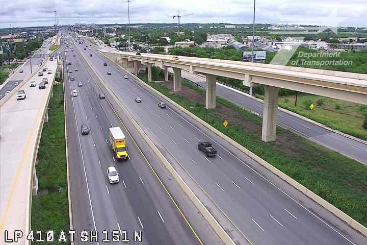
This traffic camera monitors LP-410 in San Antonio, Texas, with a southbound view.

Multiple National Weather Service alerts are active for this camera area. Review the alert details below before traveling through this corridor.

Light rain is reported near this camera, with temperatures near 81.2 °F. Allow extra braking distance and watch for spray from nearby traffic.

Additional rain is expected over the next few days, which could keep pavement conditions variable in the San Antonio area.

Camera Information & Location Details

Highway/Roadway
LP-410
Traffic Direction
South
County
Bexar
City
San Antonio
Feed Type
Still Image
Geographic Coordinates
29.43629, -98.64515
Source Provider
TxDOT
National Weather Service warning

Active Weather Alert near this camera

Hazardous weather is occurring or expected soon near this camera area.

3 alerts
Alert

Flood Warning

Severe Expected

Flood Warning issued June 15 at 8:28AM CDT until June 16 at 3:49AM CDT by NWS Austin/San Antonio TX

Alert Details

...The National Weather Service in Austin/San Antonio TX has issued a Flood Warning for the following rivers in Texas... Leon Creek At I-35S near San Antonio affecting Bexar County. * WHAT...Moderate flooding is forecast. * WHERE...Leon Creek at I-35S near San Antonio. * WHEN...From this afternoon to late tonight. * IMPACTS...At 16.0 feet, Camargo Park near Nelson Wolff Stadium will begin to see water entering the park in areas that are close to the creek. Primary and secondary roads and bridges will begin to see flooding from above Kelly USA to below I-35. Flow approaches horse barns and homes below Kelly USA. * ADDITIONAL DETAILS... - At 8:15 AM CDT Monday the stage was 5.8 feet. - Bankfull stage is 13.0 feet. - Forecast...The river is expected to rise above flood stage this afternoon to a crest of 16.4 feet late this afternoon. It will then fall below flood stage late this evening. - Flood stage is 15.0 feet. - Flood History...This crest compares to a previous crest of 17.1 feet on 07/22/2007. - http://www.weather.gov/safety/flood

Recommended Action

Turn around, don't drown when encountering flooded roads. Most flood deaths occur in vehicles. Motorists should not attempt to drive around barricades or drive cars through flooded areas. Additional information is available at www.weather.gov. The next statement will be issued late tonight by 230 AM CDT.

Active until
2026-06-16 08:49:00 UTC
Certainty
Likely
Area
Bexar, TX
Alert

Flood Watch

Severe Future

Flood Watch issued June 14 at 9:31PM CDT until June 16 at 7:00PM CDT by NWS Austin/San Antonio TX

Alert Details

* WHAT...Flooding caused by excessive rainfall continues to be possible. * WHERE...A portion of south central Texas, including the following counties, Atascosa, Bandera, Bastrop, Bexar, Blanco, Burnet, Caldwell, Comal, De Witt, Dimmit, Edwards, Fayette, Frio, Gillespie, Gonzales, Guadalupe, Hays, Karnes, Kendall, Kerr, Kinney, Lavaca, Lee, Llano, Maverick, Medina, Real, Travis, Uvalde, Val Verde, Williamson, Wilson and Zavala. * WHEN...Through Tuesday evening. * IMPACTS...There is a potential for life threatening flooding somewhere in the watch area. Excessive runoff may result in flooding of rivers, creeks, streams, and other low-lying and flood-prone locations. Creeks and streams may rise out of their banks. Low-water crossings may be flooded. * ADDITIONAL DETAILS... - Very humid tropical air and a stalling front will result in heavy rain. Isolated pockets with rain totals of 8 inches or more are possible with rain rates that could exceed 2 to 3 inches per hour at times. - http://www.weather.gov/safety/flood

Recommended Action

You should monitor later forecasts and be alert for possible Flood Warnings. Those living in areas prone to flooding should be prepared to take action should flooding develop.

Active until
2026-06-17 00:00:00 UTC
Certainty
Possible
Area
Llano; Burnet; Williamson; Val Verde; Edwards; Real; Kerr; Bandera; Gillespie; Kendall; Blanco; Hays; Travis; Bastrop; Lee; Kinney; Uvalde; Medina; Bexar; Comal; Guadalupe; Caldwell; Fayette; Maverick; Zavala; Frio; Atascosa; Wilson; Karnes; Gonzales; De Witt; Lavaca; Dimmit
Alert

Flood Advisory

Minor Expected

Flood Advisory issued June 15 at 10:32AM CDT until June 15 at 11:45AM CDT by NWS Austin/San Antonio TX

Alert Details

* WHAT...Flooding caused by earlier excessive rainfall. * WHERE...A portion of south central Texas, including the following counties, Bexar and Medina. * WHEN...Until 1145 AM CDT. * IMPACTS...Minor flooding in low-lying and poor drainage areas. Water over roadways. * ADDITIONAL DETAILS... - At 1029 AM CDT, Emergency management had reported water rescues, several low water crossing closures and thunderstorms that had previously produce heavy rain across the warned area.Minor flooding is already occurring in the advisory area. Between 2 and 4 inches of rain have fallen. Flooding continues across the advisory area but has decreased from earlier. - Additional rainfall amounts up to 0.5 inches are expected the area. Continue to heed remaining road closures and monitor for rises in any local creeks or streams with continued runoff. - Some locations that will experience flooding include... San Antonio, Schertz, Cibolo, Converse, Universal City, Live Oak, Selma, Castroville, San Antonio Int Airport, Stinson Municipal Airport, Randolph AFB, Leon Valley, Helotes, Fair Oaks Ranch, Kirby, Alamo Heights, Windcrest, Terrell Hills, Bulverde and Shavano Park. - http://www.weather.gov/safety/flood

Recommended Action

Turn around, don't drown when encountering flooded roads. Most flood deaths occur in vehicles. Be aware of your surroundings and do not drive on flooded roads.

Active until
2026-06-15 16:45:00 UTC
Certainty
Likely
Area
Bexar, TX; Medina, TX

Current Weather near traffic camera in San Antonio, Texas

Rain: Slight

Weather data provided by the USRoadFeeds Weather Network
Road Conditions in San Antonio, Texas
Wet conditions
Active precipitation is reported near this camera.
Temperature
81.2 °F
Feels Like
89.0 °F
Humidity
75%
Wind
3.8 mph
Wind Direction
SE (126°)
Precipitation
0.02 inch


Forecast

Mon, Jun 15
Heavy rain
Max
84.5 °F
Min
74.8 °F
Precip.
1.11 inch
Status
Heavy rain
Tue, Jun 16
Moderate rain
Max
81.4 °F
Min
72.1 °F
Precip.
0.13 inch
Status
Moderate rain
Wed, Jun 17
Clear sky
Max
91.3 °F
Min
71.0 °F
Precip.
0.00 inch
Status
Clear sky

Observed at: 2026-06-15 15:00 UTC (weather data updated hourly)

Nearby Cameras