Live Traffic Camera: ATL.IH20.US59 (North)
Marshall, Texas
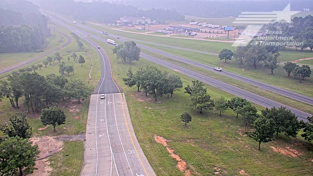
This traffic camera monitors US-59 in Marshall, Texas, with a northbound view.
Multiple National Weather Service alerts are active for this camera area. Review the alert details below before traveling through this corridor.
Light rain is reported near this camera, with temperatures near 70.4 °F. Allow extra braking distance and watch for spray from nearby traffic.
Additional rain is expected over the next few days, which could keep pavement conditions variable in the Marshall area.
Camera Information & Location Details
- Highway/Roadway
- US-59
- Traffic Direction
- North
- County
- Harrison
- City
- Marshall
- Feed Type
- Still Image
- Geographic Coordinates
- 32.49225, -94.35884
- Source Provider
- TxDOT
Real-Time Mapping
Active Weather Alert near this camera
Hazardous weather is occurring or expected soon near this camera area.
Flash Flood Warning
Flash Flood Warning issued June 15 at 11:19AM CDT until June 15 at 2:15PM CDT by NWS Shreveport LA
FFWSHV The National Weather Service in Shreveport has issued a * Flash Flood Warning for... Northern Shelby County in eastern Texas... Southeastern Gregg County in northeastern Texas... Harrison County in northeastern Texas... Panola County in northeastern Texas... Rusk County in northeastern Texas... * Until 215 PM CDT. * At 1119 AM CDT, Doppler radar indicated thunderstorms producing heavy rain across the warned area. Flash flooding is ongoing or expected to begin shortly. HAZARD...Flash flooding caused by thunderstorms. SOURCE...Radar indicated. IMPACT...Flash flooding of small creeks and streams, urban areas, highways, streets and underpasses as well as other poor drainage and low-lying areas. * Some locations that will experience flash flooding include... Longview, Marshall, Henderson, Carthage, Hallsville, Waskom, Tatum, Tenaha, Timpson, Beckville, Joaquin, Pinehill, Deberry, Elysian Fields, Minden, Woodlawn, Harleton and Lakeport.
Turn around, don't drown when encountering flooded roads. Most flood deaths occur in vehicles.
- Active until
- 2026-06-15 19:15:00 UTC
- Certainty
- Likely
- Area
- Gregg, TX; Harrison, TX; Panola, TX; Rusk, TX; Shelby, TX
Flood Watch
Flood Watch issued June 14 at 9:21PM CDT until June 16 at 7:00PM CDT by NWS Shreveport LA
* WHAT...Flooding caused by excessive rainfall is possible. * WHERE...Portions of Louisiana, including the following parishes, Bienville, Bossier, Caddo, Caldwell, Claiborne, De Soto, Grant, Jackson, La Salle, Lincoln, Natchitoches, Ouachita, Red River, Sabine, Union, Webster and Winn and Texas, including the following counties, Angelina, Cherokee, Gregg, Harrison, Marion, Nacogdoches, Panola, Rusk, Sabine, San Augustine, Shelby and Smith. * WHEN...Through Tuesday evening. * IMPACTS...Excessive runoff may result in flooding of rivers, creeks, streams, and other low-lying and flood-prone locations. Flooding may occur in poor drainage and urban areas. * ADDITIONAL DETAILS... - A weak surface front will remain stationary across East Texas and North Louisiana through Tuesday. Periods of showers and thunderstorms, some containing heavy rainfall, will develop tonight through Tuesday across the watch area. These showers and thunderstorms will be efficient rainfall producers, with rainfall amounts of 1 to 3 inches expected, with isolated higher amounts in excess of 5 inches possible, much of which may fall in a short period of time. Thus, the potential for at least localized flash flooding will exist across portions of East Texas and North Louisiana through Tuesday afternoon. - http://www.weather.gov/safety/flood
You should monitor later forecasts and be alert for possible Flood Warnings. Those living in areas prone to flooding should be prepared to take action should flooding develop.
- Active until
- 2026-06-17 00:00:00 UTC
- Certainty
- Possible
- Area
- Caddo; Bossier; Webster; Claiborne; Lincoln; Union; De Soto; Red River; Bienville; Jackson; Ouachita; Sabine; Natchitoches; Winn; Grant; Caldwell; La Salle; Marion; Smith; Gregg; Harrison; Cherokee; Rusk; Panola; Nacogdoches; Shelby; Angelina; San Augustine; Sabine
Current Weather near traffic camera in Marshall, Texas
Rain: Slight
- Temperature
- 70.4 °F
- Feels Like
- 76.0 °F
- Humidity
- 99%
- Wind
- 6.0 mph
- Wind Direction
- ENE (59°)
- Precipitation
- 0.01 inch
Forecast
- Max
- 77.4 °F
- Min
- 70.4 °F
- Precip.
- 0.64 inch
- Status
- Heavy rain
- Max
- 83.2 °F
- Min
- 69.5 °F
- Precip.
- 0.31 inch
- Status
- Moderate rain
- Max
- 90.2 °F
- Min
- 69.7 °F
- Precip.
- 0.00 inch
- Status
- Clear sky
Observed at: 2026-06-15 16:00 UTC (weather data updated hourly)
Nearby Cameras
US 59 at Bell St
Marshall
US-59
Direction: North
Distance: 2.2 miles
Axis camera
Marshall
US-59
Direction: North
Distance: 3.9 miles
IH20 at COOKS.RD
Unknown
I-20
Direction: East
Distance: 4.4 miles
IH20.WEST.OF.FM2199
Unknown
I-20
Direction: West
Distance: 5.3 miles
US 80 at Trinity Services
Unknown
US-80
Direction: North
Distance: 16.7 miles
IH20 at Louisiana SL
Unknown
I-20
Direction: West
Distance: 18.4 miles
IH20 at GREGG CL
Unknown
I-20
Direction: East
Distance: 19.6 miles
IH20 at SH149
Unknown
I-20
Direction: West
Distance: 20.2 miles
IH20 at SL 281
Longview
I-20
Direction: West
Distance: 21.4 miles