Live Traffic Camera: LP20 @ Casa Blanca (East)
Laredo, Texas
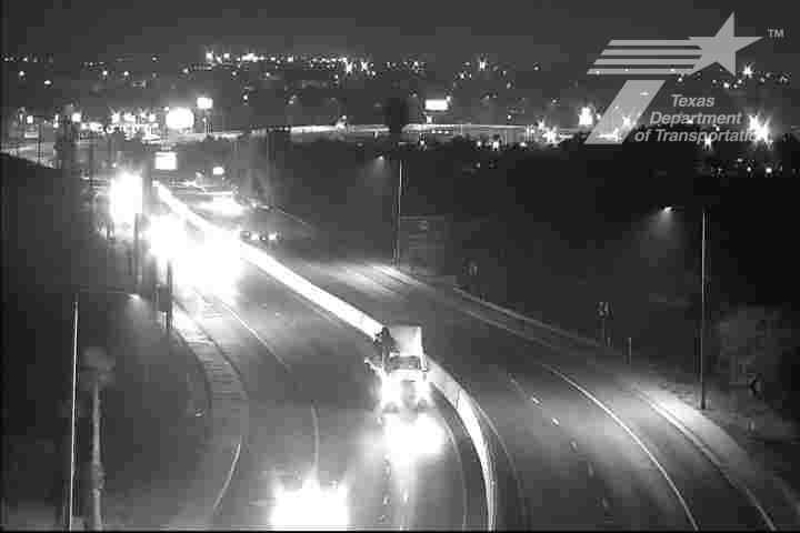
This traffic camera monitors LP-20 in Laredo, Texas, with a eastbound view.
Multiple National Weather Service alerts are active for this camera area. Review the alert details below before traveling through this corridor.
Light rain is reported near this camera, with temperatures near 79.2 °F. Allow extra braking distance and watch for spray from nearby traffic.
A later forecast includes precipitation, including heavy rain, so conditions may change after the current camera view.
Camera Information & Location Details
- Highway/Roadway
- LP-20
- Traffic Direction
- East
- County
- Webb
- City
- Laredo
- Feed Type
- Still Image
- Geographic Coordinates
- 27.54037, -99.45277
- Source Provider
- TxDOT
Real-Time Mapping
Active Weather Alert near this camera
Conditions are favorable for hazardous weather nearby, even if the current camera view looks calm.
Flood Watch
Flood Watch issued June 15 at 11:17AM CDT until June 18 at 7:00AM CDT by NWS Corpus Christi TX
* WHAT...Flooding caused by excessive rainfall continues to be possible. * WHERE...A portion of south Texas, including the following areas, Aransas Islands, Bee, Calhoun Islands, Coastal Aransas, Coastal Calhoun, Coastal Kleberg, Coastal Nueces, Coastal Refugio, Coastal San Patricio, Duval, Goliad, Inland Calhoun, Inland Kleberg, Inland Nueces, Inland Refugio, Inland San Patricio, Jim Wells, Kleberg Islands, La Salle, Live Oak, McMullen, Nueces Islands, Victoria and Webb. * WHEN...Through Thursday morning. * IMPACTS...Excessive runoff may result in flooding of rivers, creeks, streams, and other low-lying and flood-prone locations. Creeks and streams may rise out of their banks. Low-water crossings may be flooded. * ADDITIONAL DETAILS... - The combination of a moist tropical airmass, a stalling front, and a broad area of low pressure over eastern Mexico will result in heavy rain. Isolated pockets with rain totals of 6-8 inches or more are possible with rain rates that could exceed 2-4 inches per hour at times. There is an increased danger to lives and property due to flash flooding. Life threatening flash flooding is possible in the watch area. - http://www.weather.gov/safety/flood
You should monitor later forecasts and be alert for possible Flood Warnings. Those living in areas prone to flooding should be prepared to take action should flooding develop.
- Active until
- 2026-06-18 12:00:00 UTC
- Certainty
- Possible
- Area
- La Salle; McMullen; Live Oak; Bee; Goliad; Victoria; Webb; Duval; Jim Wells; Inland Kleberg; Inland Nueces; Inland San Patricio; Coastal Aransas; Inland Refugio; Inland Calhoun; Coastal Kleberg; Coastal Nueces; Coastal San Patricio; Aransas Islands; Coastal Refugio; Coastal Calhoun; Kleberg Islands; Nueces Islands; Calhoun Islands
Flood Warning
Flood Warning issued June 15 at 10:04AM CDT until June 18 at 2:00PM CDT by NWS Corpus Christi TX
...The National Weather Service in Corpus Christi has issued a Flood Warning for the following rivers in Texas... Rio Grande At Laredo affecting Webb County. For the Rio Grande...including Columbia Bridge, Laredo...Minor flooding is forecast. * WHAT...Minor flooding is forecast. * WHERE...Rio Grande at Laredo. * WHEN...From Tuesday morning to Thursday afternoon. * ADDITIONAL DETAILS... - At 9:00 AM CDT Monday the stage was 3.1 feet (0.9 meters). - Bankfull stage is 7.0 feet (2.1 meters). - Forecast...The river is expected to rise above flood stage late tomorrow morning to a crest of 10.5 feet (3.2 meters) early Wednesday morning. It will then fall below flood stage late Wednesday evening. - Flood stage is 8.0 feet (2.4 meters). - Flood History...This crest compares to a previous crest of 10.5 feet (3.2 meters) on 09/20/1991. - http://www.weather.gov/safety/flood
Motorists should not attempt to drive around barricades or drive cars through flooded areas. Please report observed flooding to local emergency services or law enforcement and request they pass this information to the National Weather Service when you can do so safely. Additional information is available at www.weather.gov/crp.
- Active until
- 2026-06-18 19:00:00 UTC
- Certainty
- Likely
- Area
- Webb, TX
Current Weather near traffic camera in Laredo, Texas
Rain: Slight
- Temperature
- 79.2 °F
- Feels Like
- 85.4 °F
- Humidity
- 85%
- Wind
- 10.2 mph
- Wind Direction
- ENE (64°)
- Precipitation
- 0.02 inch
Forecast
- Max
- 85.6 °F
- Min
- 72.9 °F
- Precip.
- 0.89 inch
- Status
- Heavy rain
- Max
- 98.0 °F
- Min
- 72.9 °F
- Precip.
- 0.00 inch
- Status
- Clear sky
- Max
- 104.3 °F
- Min
- 79.6 °F
- Precip.
- 0.00 inch
- Status
- Clear sky
Observed at: 2026-06-16 01:00 UTC (weather data updated hourly)
Nearby Cameras
US59 at Casa Blanca
Laredo
US-59
Direction: North
Distance: 0.8 miles
LP20 @ Sinatra
Laredo
LP-20
Direction: East
Distance: 0.9 miles
US59 @ LP20
Laredo
US-59
Direction: North
Distance: 1.0 miles
LP20 @ Fairfield
Laredo
LP-20
Direction: East
Distance: 1.3 miles
LP20 @ Lakeview
Laredo
LP-20
Direction: East
Distance: 1.6 miles
LP20 @ Spur 400
Laredo
LP-20
Direction: East
Distance: 1.6 miles
LP20 @ University
Laredo
LP-20
Direction: East
Distance: 2.5 miles
US83 @ Bartlett WB
Laredo
US-83
Direction: West
Distance: 2.7 miles
US83 @ Market
Laredo
US-83
Direction: North
Distance: 2.7 miles