Live Traffic Camera: SH360 @ IH20 HM NB (North)
Arlington, Texas
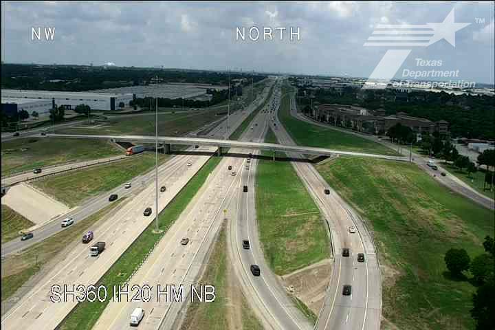
This traffic camera monitors TX-360 in Arlington, Texas, with a northbound view.
Multiple National Weather Service alerts are active for this camera area. Review the alert details below before traveling through this corridor.
Current weather data is not available for this camera, so drivers should rely on the live image and local advisories before traveling through the Arlington area.
Camera Information & Location Details
- Highway/Roadway
- TX-360
- Traffic Direction
- North
- County
- Tarrant
- City
- Arlington
- Feed Type
- Still Image
- Geographic Coordinates
- 32.67785, -97.06215
- Source Provider
- TxDOT
Real-Time Mapping
Active Weather Alert near this camera
Hazardous weather is occurring or expected soon near this camera area.
Severe Thunderstorm Warning
Severe Thunderstorm Warning issued June 6 at 7:54PM CDT until June 6 at 8:15PM CDT by NWS Fort Worth TX
At 753 PM CDT, a severe thunderstorm was located just south of Mansfield, moving northeast at 20 mph. HAZARD...65 mph wind gusts and penny size hail. SOURCE...Radar indicated. IMPACT...Expect damage to roofs, siding, and trees. This severe storm will be near... Grand Prairie, Mansfield, Cedar Hill, Midlothian, and Cedar Hill State Park around 800 PM CDT. Desoto, Duncanville, and Ovilla around 815 PM CDT. Glenn Heights around 820 PM CDT. Other locations impacted by this severe thunderstorm include Mountain Creek Lake, Joe Pool Lake, and Lillian.
Continuous cloud to ground lightning is occurring with this storm. Move indoors immediately.
- Active until
- 2026-06-07 01:15:00 UTC
- Certainty
- Observed
- Area
- Dallas, TX; Ellis, TX; Johnson, TX; Tarrant, TX
Flood Watch
Flood Watch issued June 6 at 7:47PM CDT until June 7 at 4:00PM CDT by NWS Fort Worth TX
* WHAT...Flooding caused by excessive rainfall continues to be possible. * WHERE...Most of western North Texas, roughly along and west of Interstate 35. * WHEN...Through Sunday afternoon. * IMPACTS...Excessive runoff may result in flooding of rivers, creeks, streams, and other low-lying and flood-prone locations. * ADDITIONAL DETAILS... - Widespread rainfall amounts of 1 to 3 inches are expected with localized rainfall totals as high as 6 to 8 inches possible. The heaviest rainfall is expected from Saturday evening into Sunday morning. - http://www.weather.gov/safety/flood
You should monitor later forecasts and be alert for possible Flood Warnings. Those living in areas prone to flooding should be prepared to take action should flooding develop.
- Active until
- 2026-06-07 21:00:00 UTC
- Certainty
- Possible
- Area
- Montague; Cooke; Grayson; Fannin; Young; Jack; Wise; Denton; Collin; Stephens; Palo Pinto; Parker; Tarrant; Dallas; Eastland; Erath; Hood; Somervell; Johnson; Ellis; Comanche
Nearby Cameras
IH20 @ Great Southwest
Grand Prairie
I-20
Direction: East
Distance: 1.1 miles
IH20 @ Dallas-Tarrant CL
Grand Prairie
I-20
Direction: East
Distance: 1.5 miles
IH20 @ Dallas-Tarrant CL
Grand Prairie
I-20
Direction: East
Distance: 1.5 miles
IH20 @ Collins
Arlington
I-20
Direction: East
Distance: 1.7 miles
IH20 @ PGBT (SH161)
Grand Prairie
I-20
Direction: East
Distance: 2.2 miles
IH20 @ PGBT (SH161)
Grand Prairie
I-20
Direction: East
Distance: 2.2 miles
IH20 @ Osprey
Arlington
I-20
Direction: East
Distance: 2.2 miles
IH20 @ Robinson Rd
Grand Prairie
I-20
Direction: East
Distance: 2.8 miles
IH20 @ Robinson Rd
Grand Prairie
I-20
Direction: East
Distance: 2.8 miles