Live Traffic Camera: SR-60 : (533) Fullerton Rd (East)
Rowland Heights, California
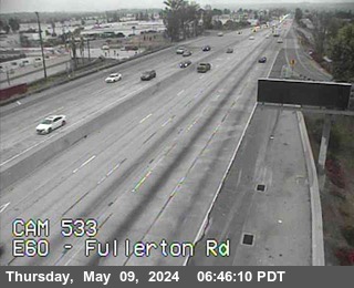
All cameras on State Route 60 (CA) in California →This traffic camera monitors SR-60 in Rowland Heights, California, with a eastbound view.
Current weather near this camera is dry, with clear sky and temperatures near 66.8 °F.
The live view is most useful for checking traffic flow, visibility, and any lane restrictions before driving through the Rowland Heights area.
Camera Information & Location Details
- Highway/Roadway
- SR-60
- Traffic Direction
- East
- County
- Los Angeles
- City
- Rowland Heights
- Feed Type
- Still Image
- Geographic Coordinates
- 33.99397, -117.90688
- Source Provider
- Caltrans
Real-Time Mapping
Current Weather near traffic camera in Rowland Heights, California
Clear sky
- Temperature
- 66.8 °F
- Feels Like
- 67.1 °F
- Humidity
- 69%
- Wind
- 4.2 mph
- Wind Direction
- SSW (205°)
- Precipitation
- 0.00 inch
Forecast
- Max
- 83.4 °F
- Min
- 63.8 °F
- Precip.
- 0.00 inch
- Status
- Clear sky
- Max
- 78.9 °F
- Min
- 64.1 °F
- Precip.
- 0.00 inch
- Status
- Clear sky
- Max
- 80.9 °F
- Min
- 63.0 °F
- Precip.
- 0.00 inch
- Status
- Clear sky
Observed at: 2026-06-17 15:00 UTC (weather data updated hourly)
Nearby Cameras
SR-60 : (534) East of Nogales St
Rowland Heights
SR-60
Direction: East
Distance: 1.4 miles
SR-60 : (532) Azusa Ave
Hacienda Heights
SR-60
Direction: East
Distance: 1.5 miles
SR-60 : (535) West of Brea Canyon
Walnut
SR-60
Direction: West
Distance: 3.1 miles
SR-60 : (531) Hacienda Blvd
Hacienda Heights
SR-60
Direction: East
Distance: 3.5 miles
SR-57 : (185) North of Tonner Canyon Road
Brea
SR-57
Direction: North
Distance: 4.1 miles
SR-57 : (184) South of Tonner Canyon Road
Brea
SR-57
Direction: North
Distance: 4.3 miles
SR-57: (909) Lambert
Brea
SR-57
Distance: 4.4 miles
SR-60 : (530) East of Seventh Ave
Hacienda Heights
SR-60
Direction: East
Distance: 4.8 miles
SR-57 : (82) Lambert Street
Brea
SR-57
Direction: North
Distance: 5.0 miles