Live Traffic Camera: Hatchet Mtn (N/A)
Burney, California
All cameras on State Route 299 (CA) in California →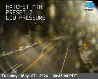
This traffic camera monitors SR-299 in Burney, California.
Current weather near this camera is dry, with clear sky and temperatures near 50.1 °F.
The live view is most useful for checking traffic flow, visibility, and any lane restrictions before driving through the Burney area.
Additional rain is expected over the next few days, which could keep pavement conditions variable in the Burney area.
Camera Information & Location Details
- Highway/Roadway
- SR-299
- Traffic Direction
- N/A
- County
- Shasta
- City
- Burney
- Feed Type
- Still Image
- Geographic Coordinates
- 40.85216, -121.76202
- Source Provider
- Caltrans
Real-Time Mapping
Current Weather near traffic camera in Burney, California
Clear sky
- Temperature
- 50.1 °F
- Feels Like
- 43.7 °F
- Humidity
- 40%
- Wind
- 4.4 mph
- Wind Direction
- ESE (120°)
- Precipitation
- 0.00 inch
Forecast
- Max
- 68.1 °F
- Min
- 38.2 °F
- Precip.
- 0.00 inch
- Status
- Clear sky
- Max
- 66.8 °F
- Min
- 45.8 °F
- Precip.
- 0.03 inch
- Status
- Slight rain
- Max
- 69.0 °F
- Min
- 44.3 °F
- Precip.
- 0.03 inch
- Status
- Slight rain
Observed at: 2026-06-07 05:00 UTC (weather data updated hourly)
Nearby Cameras
Montgomery Creek
Montgomery Creek
SR-299
Distance: 7.4 miles
SR299-SR89
Burney
SR-299
Distance: 10.0 miles
Lassen Park
Old Station
SR-44
Distance: 23.3 miles
Shingletown
Shingletown
SR-44
Distance: 25.7 miles
Obrien
Lakehead
I-5
Distance: 29.5 miles
Sidehill
Lakehead
I-5
Distance: 29.6 miles
Pit River Bridge
Redding
I-5
Distance: 29.9 miles
Salt Creek
Lakehead
I-5
Direction: North
Distance: 30.3 miles
Fawndale
Redding
I-5
Distance: 30.4 miles